During my unexpected summer on this agricultural island cum vacation refuge for the rich, I've done what I always do and gone looking for trails. As a Californian, I've had some learning to do.
- They don't do public lands on this side of the country. Most land has been privately owned for hundreds of years. In general, landowners jealously guard against trespassers.
- Land that is available to the public often consists of conservation easements and the holdings of a few non-profit conservation outfits. Martha's Vineyard actually is fortunate to have the Vineyard Conservation Society and the Sheriff's Meadow Foundation, among other non-profits. A public entity, the Martha's Vineyard Land Bank, uses the proceeds of a real estate transfer tax to buy up land for public use. Something over 10 percent of the land is under various conservation restrictions, but that doesn't mean it is publicly accessible.
- One of the factors ensuring that access remains restricted is that there is no legal place to park a car adjacent to most of the wilder areas. If you don't live nearby, it takes some ingenuity to get to a trail head.
- That is assuming that you can find a trail head. Many, perhaps most are not marked or marked at one end only. I found more than one by simply nosing around off dirt roads, hoping that the path I was following wouldn't end up in someone's back yard. I had already found most of the nearby ones before I learned that the Vineyard Conservation Society sells a small book with pretty good directions to many of the island's trails.

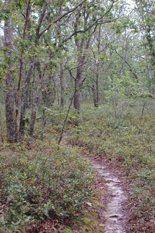
These third growth woods are support a lot of underbrush, almost thickets at times.
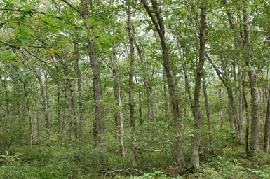
The greens in these woods are intense.
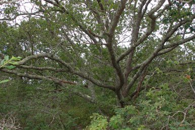
Rare older trees are majestic.

Woodpeckers ate well on whatever this dead tree harbored.

The Land Bank marks its trails distinctively.

And does provide some road side signs.

But this too is a trail head. Would you be able to guess?
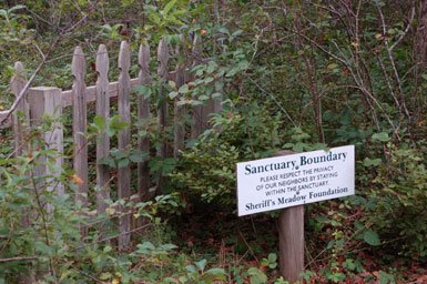
Once on the trails, the conservation outfits remind you off the neighbors' property.

Often the path will follow an old stonewall.
Very occasionally you'll pass an interesting structure. Was this a church or meetinghouse?
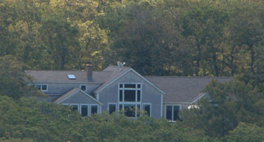
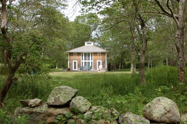
Sometimes, far off, you can spy a well hidden McMansion.
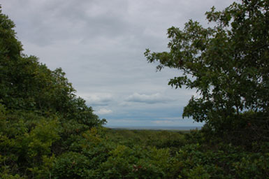
The highest point on this island is 311 feet above sea level. Trails here do not lead to dramatic vistas. The beauties are mostly more subtle. Here a glimpse of the ocean, hemmed in with greenery.
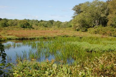
I happened on unexpected delights, such as this wetland at a tiny stream's source. It has been a tremendous privilege to explore these New England woods, to know a little of a kind of land so very unlike the area where I live.
1 comment:
You are missing California. The most beautiful of your photographs is the final one, which looks like it could be at home.
And yes, the lack of public access to the shore on much of the Northeastern Seaboard always shocked me as a native-born Californian who looked upon all shorelines as a birthright to all. Though East Coasters think of themselves as enlightened, this particular detail is just one more indication of how they are not. It depresses me that they are in charge of my federal government/empire.
Post a Comment