Like everyone else mesmerized by the spectacle on TV last week of the gas explosion and fire in San Bruno, I wondered whether I was living on top of such a potential hazard. Thanks to the
Mission Loc@l, I learned it is possible for anyone to find out from a map at
the Pipeline and Hazardous Materials Safety Administration, within the U.S. Department of Transportation. (You need a fast connection for this one; the site is huge and slow.)
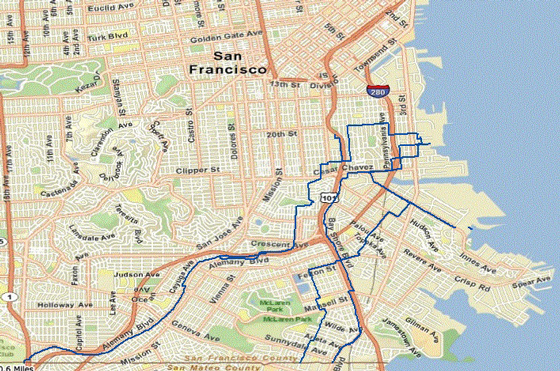
Here's the map for San Francisco:

The blue lines show the pipes. Looks like the same people who get the freeway fumes also are most at risk if more of PG&E's old pipes are getting frayed.


No comments:
Post a Comment